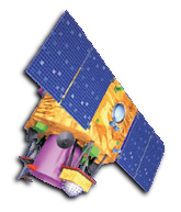
The Indian Remote Sensing Satellite IRS Cartosat-2 has been successfully launched into polar orbit on January 10, 2007. The payload was lifted by the PSLV-C7 from the Satish Dhawan Space Centre, Sriharikota.
Cartosat-2 is highly agile and can be operated in different imaging modes. E.g. in spot mode, imaging in North-South direction on either side of the track, in paint-brush mode, employing roll and pitch tilt to increase the total swath, and in multi-view mode, imaging one strip three times with different look angles.
| PAN | |
|---|---|
| Tilt Across Track | ± 45 deg |
| Tilt Along Track | ± 45 deg |
| Spatial Resolution | <1 m |
| Swath-width | 9.6 km |
| Radiometric Resolution, Quantisation | 10 bit |
| Spectral Coverage | 500-850 nm |
| CCD Arrays (no. of arrays * no. of elements) |
1 * 12000 |