- Home
- »
- IRS Products
- »
- Euro-Maps 3D
Euro-Maps 3D

Euro-Maps 3D products are digital elevation models (DEMs) semi-automatically derived from 2.5 m in-flight stereo data provided by IRS-P5 Cartosat-1 and developed in cooperation with the German Aerospace Center, DLR.
Euro-Maps 3D DSM is a homogeneous, 5 m spaced digital surface model product including detailed flanking information consisting of several pixel-based quality and traceability layers.
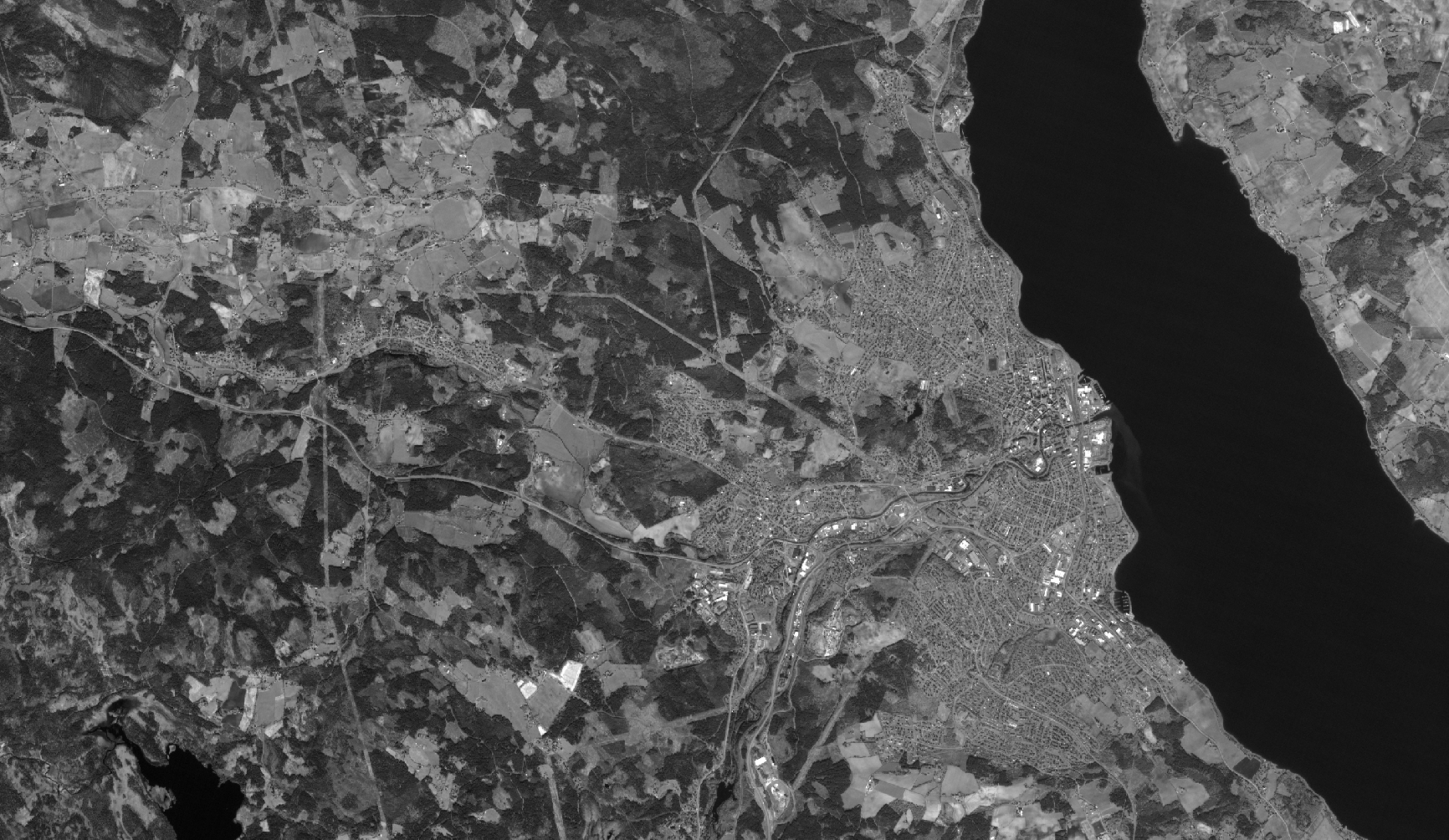
Ortho layer, for visualisation here with 5 m instead of 2.5 m resolution to match the 5 m post spacing of the DSM. Click to enlarge.
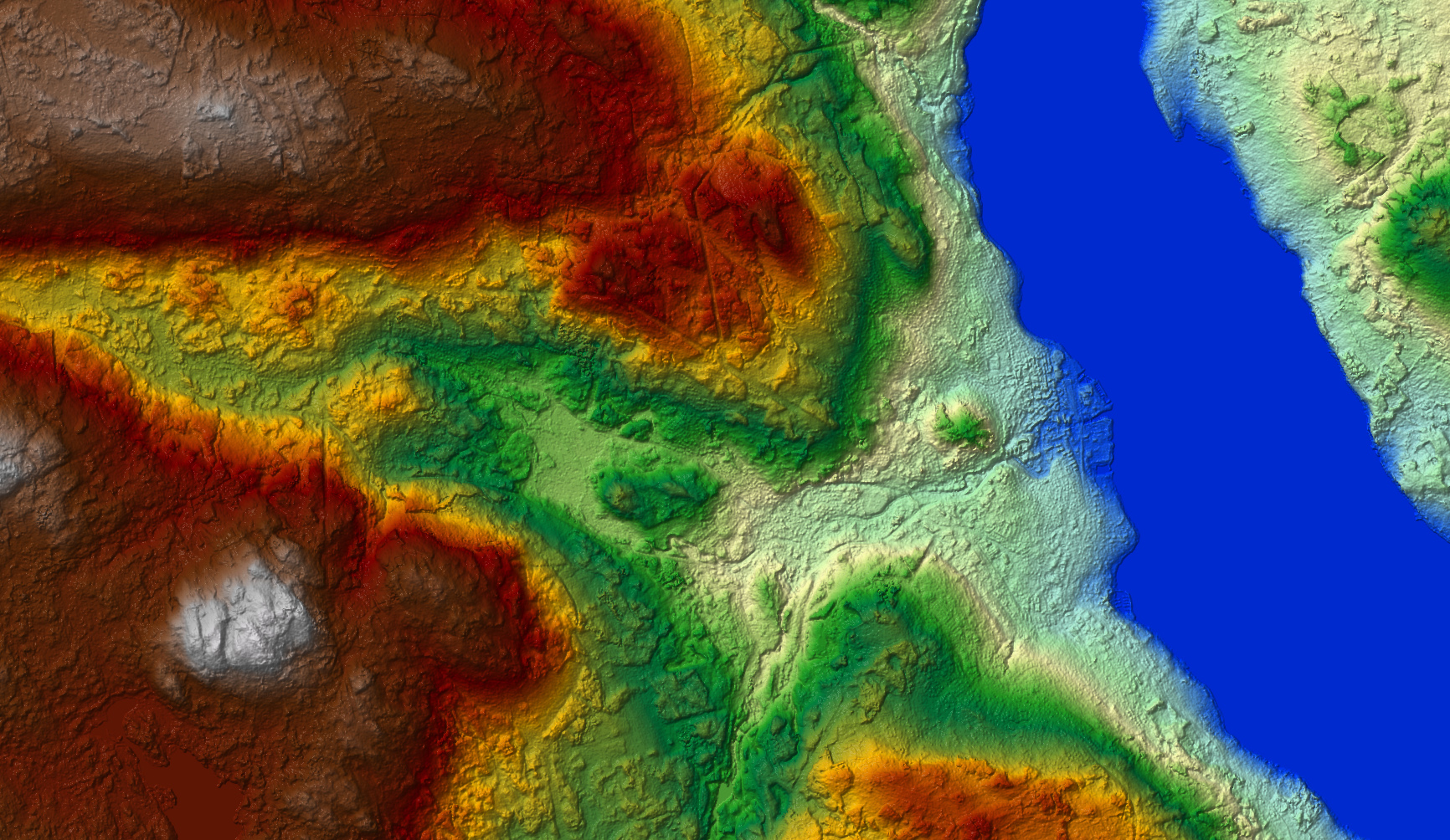
DSM, hill-shaded. Click to enlarge.
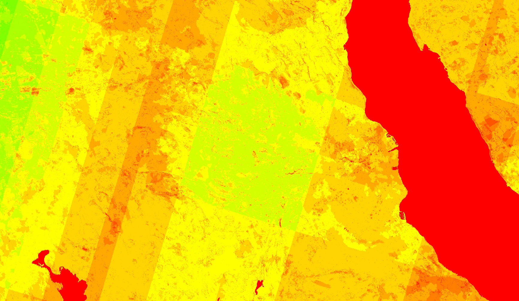
Number layer: red to lime = 0 to 12 = number of Cartosat-1 stereo pairs used for the generation of the height value. Click to enlarge.
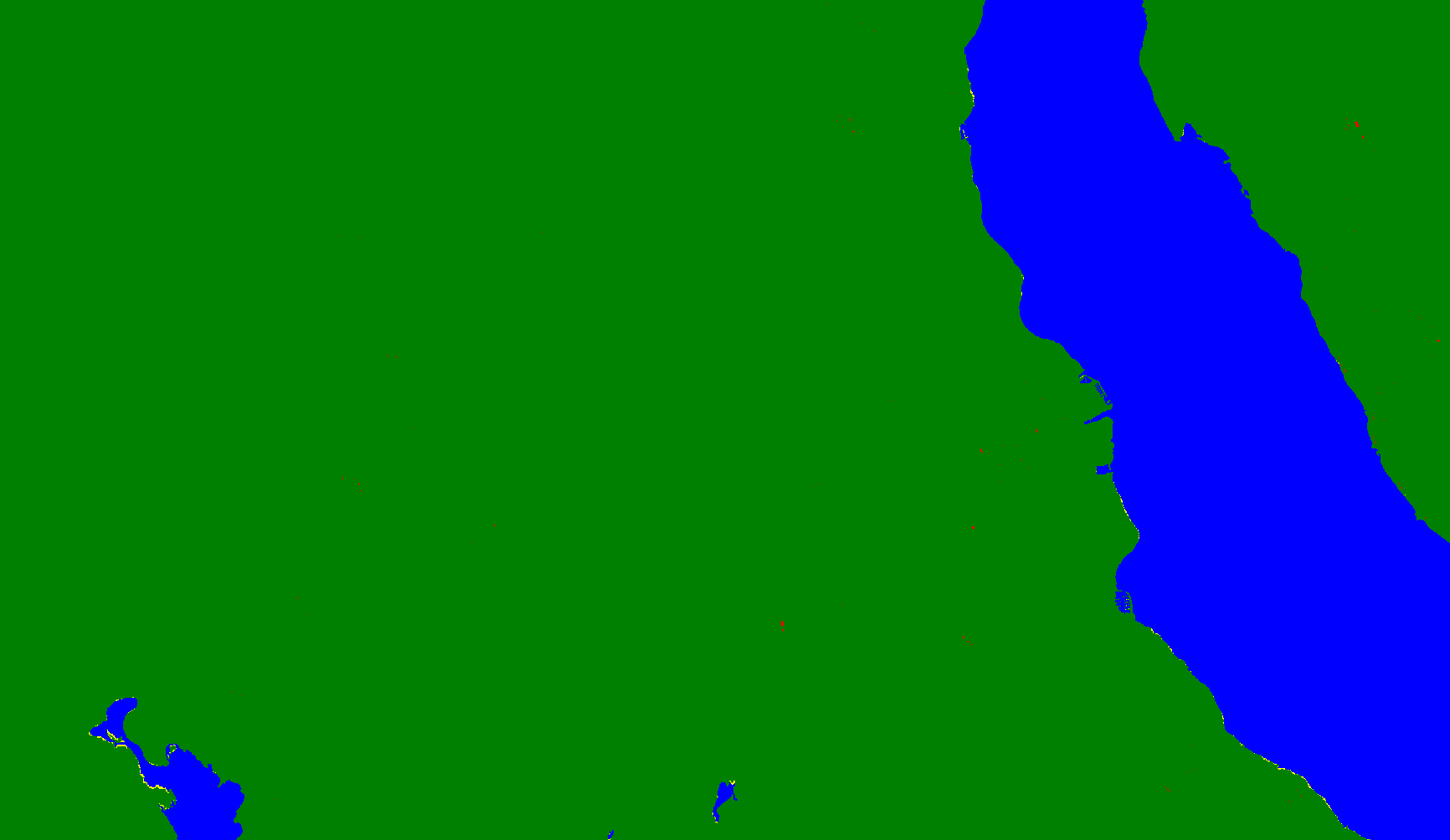
Source layer: green = derived from Cartosat-1 stereo data, red = filled with another DEM, yellow = edited manually and derived from surrounding values, blue = detected as water body and edited accordingly. Click to enlarge.
Quality layer: green = meets or exceeds the quality described in the product specification, red = may not meet the quality described in the product specification. Click to enlarge.
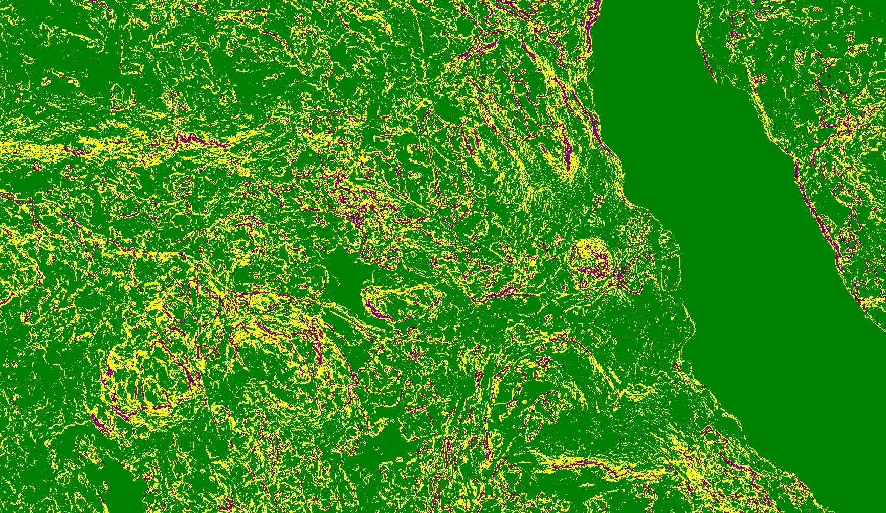
Accuracy vertical layer: green = 5 m for slopes < 20%, yellow = 7 m for slopes 20% – 40%, purple = 10 m for slopes > 40%. Click to enlarge.
Euro-Maps 3D DSM with ortho layer showing parts of Lake Mjøsa and Gjøvik.
Click to enlarge.
© GAF AG. Includes material © Antrix, distributed by GAF AG.
The Euro-Maps 3D for Ortho product consists of a 10 m digital elevation model and a 2.5 m ortho layer in the same geometry. Buildings were automatically removed from the DSM, whereas the heights of most forest areas are present in the product. Major water bodies were detected based on Sentinel-2 data and flattened. In urban areas, it is a very good approximation to a digital terrain model (DTM). This dataset is a perfect x, y and z reference for the orthorectification of HR and VHR images.
Product Overview
| Euro-Maps 3D DSM | Euro-Maps 3D for Ortho |
||
|---|---|---|---|
| Height Layer, Type | DSM | DSM | DEM consisting of a good approximation to a DTM for urban areas and a DSM elsewhere |
| Height Layer, Post Spacing | 5 m | 5 m | 10 m |
| Ortho Layer Pixel Size | - | 2.5 m | 2.5 m |
| Number Layer | + | + | - |
| Source Layer | + | + | - |
| Quality Layer | + | + | - |
| Vertical Accuracy Layer | + | + | - |
| Water Bodies | Lakes bigger than 2500 m2 and rivers wider than 50 m for more than 1 km are hydrologically corrected and consistent water flow is ensured |
Major water bodies are flattened | |
| Spatial Reference System | DD, UTM or other projections on WGS84 | ||
| Height Reference System | EGM96 | ||
| Absolute Vertical Accuracy | LE90 5-10 m * | ||
| Absolute Horizontal Accuracy | CE90 5-10 m * | ||
| Relative Vertical Accuracy | LE90 < 3 m | ||
| File Format | GeoTIFF, 16 bit | ||
| Tiling | 0.5º x 0.5º | ||
| Base Data | IRS-P5 Cartosat-1 PAN-A and PAN-F in-flight stereo data | ||
| Sample | Austria | Hungary | Bosnia |
| Product Description | |||
| Format Document | |||
* verified over 22 test sites and valid for areas with slopes less than 20º
For further information and specific price quotations please contact GAF’s customer support.
For VHR multi-stereo DSM products see GAF Elevation.