Euro-Maps LC is a homogeneous thematic land cover dataset derived from IRS-P6 Resourcesat-1 satellite data. The production process employs object oriented classification methods, interactive post processing, and independent internal quality assurance procedures.
The current Euro-Maps LC data set covers whole Germany. Other areas can be produced on request.
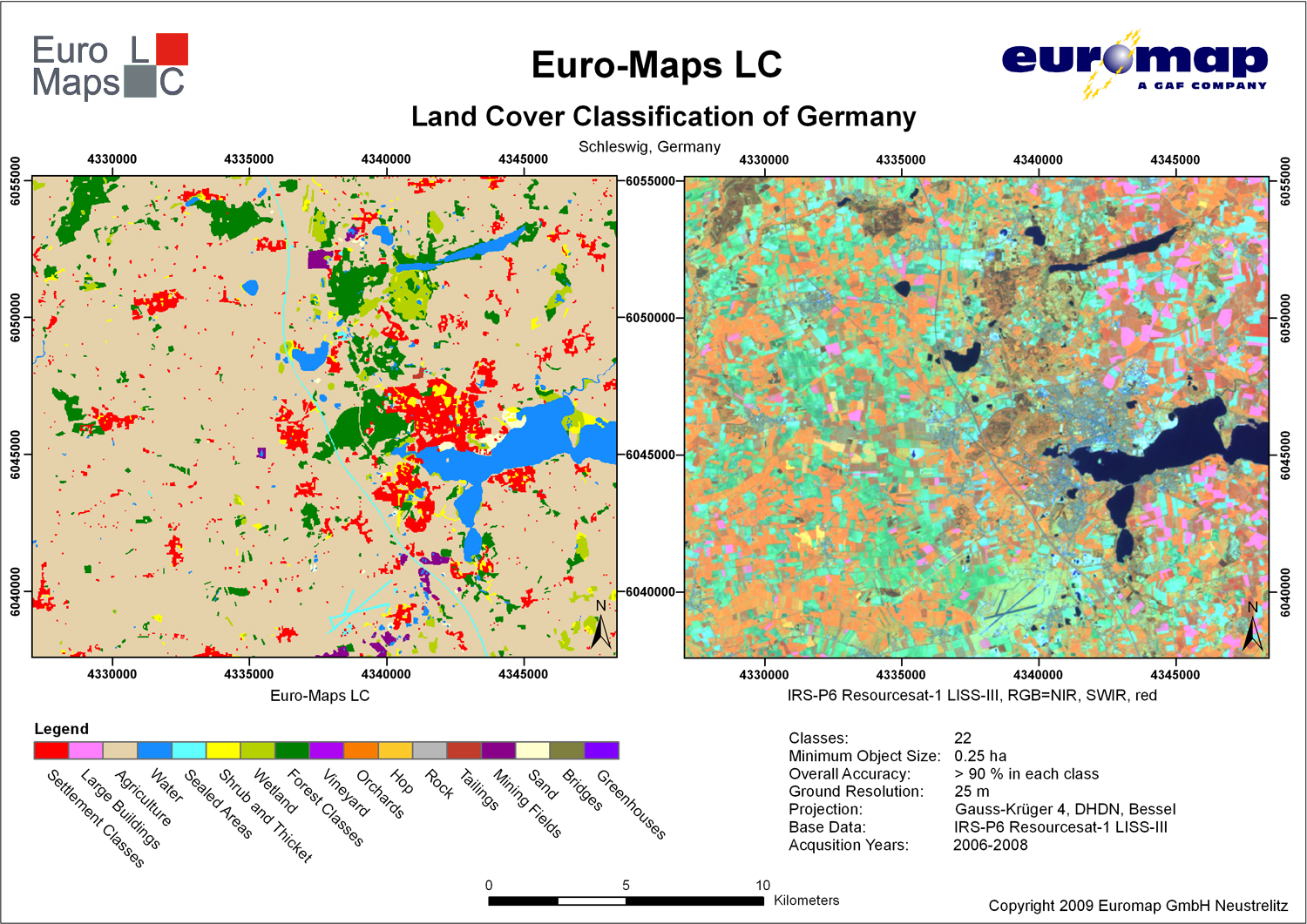
Subsets of Euro-Maps LC and IRS-P6 Resourcesat-1 LISS-III data sets
Product Overview
Number of Classes
22
Classes
Land use and land cover classes
Coverage
Germany
Minimum Object Size
0.25 ha
Overall Accuracy
> 90 % in each class
Positional Accuracy
CE90 15 m
Ground Resolution
25 m
Base Data
IRS-P6 Resourcesat-1 LISS-III
Acquisition Years
2006-2008
For further information and specific price quotations please contact our customer support. See also the German Euro-Maps LC flyer and licence.
Manage Cookie Consent
We use cookies to optimize our website and our service.
Functional
Always active
The technical storage or access is strictly necessary for the legitimate purpose of enabling the use of a specific service explicitly requested by the subscriber or user, or for the sole purpose of carrying out the transmission of a communication over an electronic communications network.
Preferences
The technical storage or access is necessary for the legitimate purpose of storing preferences that are not requested by the subscriber or user.
Statistics
The technical storage or access that is used exclusively for statistical purposes.The technical storage or access that is used exclusively for anonymous statistical purposes. Without a subpoena, voluntary compliance on the part of your Internet Service Provider, or additional records from a third party, information stored or retrieved for this purpose alone cannot usually be used to identify you.
Marketing
The technical storage or access is required to create user profiles to send advertising, or to track the user on a website or across several websites for similar marketing purposes.