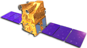
The Indian Remote Sensing Satellite IRS-P5 Cartosat-1 has been successfully launched into polar orbit on May 5, 2005. The payload was lifted by the PSLV-C6 and for the first time the new Second Launch Pad at Satish Dhawan Space Centre was used. The satellite has two panchromatic cameras that were especially designed for in flight stereo viewing.
| PAN-Fore | PAN-Aft | |
|---|---|---|
| Tilt Along Track | +26 deg | -5 deg |
| Spatial Resolution | 2.5 m | 2.5 m |
| Swath-width | 30 km | 27 km |
| Radiometric Resolution, Quantisation | 10 bit | 10 bit |
| Spectral Coverage | 500-850 nm | 500-850 nm |
| Focal Length | 1945 mm | 1945 mm |
| CCD Arrays (no. of arrays * no. of elements) |
1 * 12000 | 1 * 12000 |
| CCD Size | 7 µm x 7 µm | 7 µm x 7 µm |
| Integration Time | 0.336 ms | 0.336 ms |